


Researchers at the University of Washington have developed an algorithm that creates realistic fake satellite maps.
A growing problem of ‘deepfake geography’: How AI falsifies satellite images | UW News https://t.co/lL12oDx8Eb
— BO (@jakobzhao) April 21, 2021
The team trained a machine-learning system to link street-map details (for example, Google or Apple) with satellite images of three cities: Seattle, Tacoma and Beijing.
The developed model, given a street map as input data, returns a realistic synthetic satellite image of how the area would look in any of the listed cities.


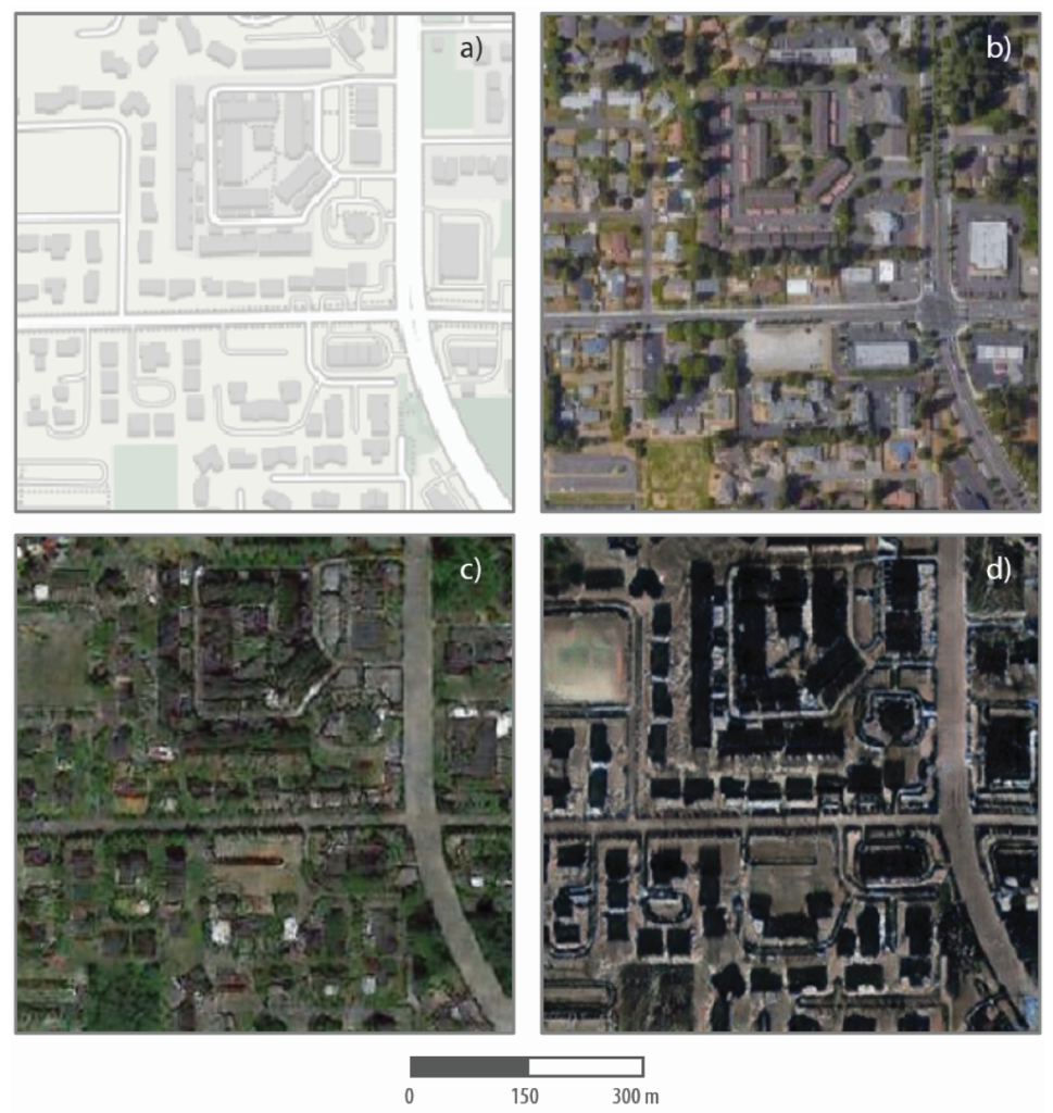
“The work calls into question the widely held assumption of the ‘absolute reliability’ of satellite imagery or other geospatial data,” said Bo Zhao, the project lead.
According to the researchers, the technique is suitable for modelling images of places for which there are no satellite photographs—for example, to recreate historical images or to simulate future urbanisation processes.
Earlier, experts found that the number of deepfakes on the internet doubles every six months.
In March 2021 in the United States arrested a woman for harassing teenage girls using a deepfake video. She aimed to discredit her daughter’s rivals in the cheerleading group.
In December 2020, British broadcaster Channel 4 released a deepfake of Queen Elizabeth II as an alternative Christmas greeting.
Subscribe to ForkLog news on Telegram: ForkLog AI — all the news from the world of AI!